Our onX Offroad Map Key
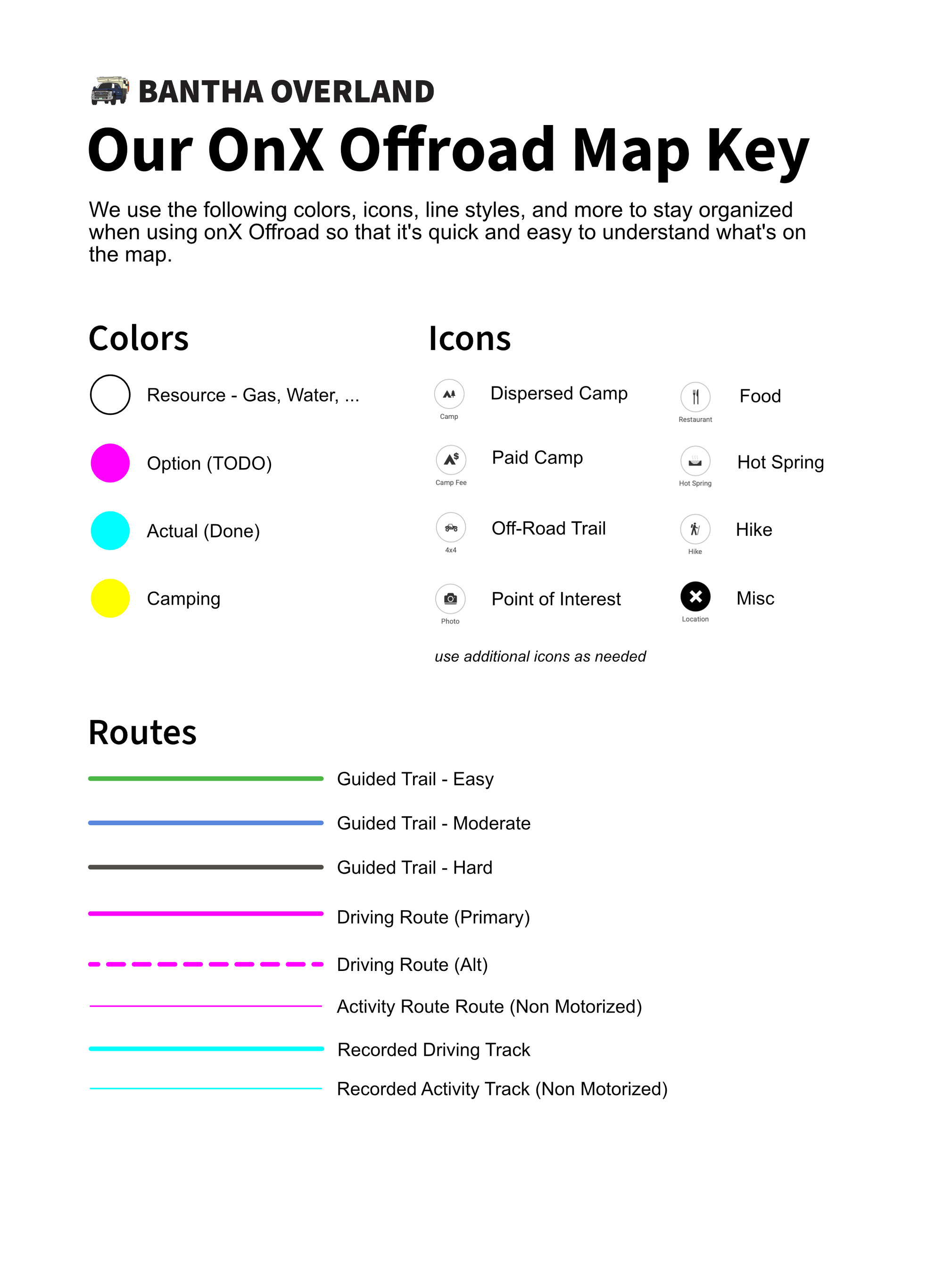
Learn about how we use colors, icons, line styles, and more to stay organized when using onX Offroad so that it's quick and easy to understand what's on the map.

While I love being out there on an adventure, I also love the process of preparing for an adventure. Identifying places to explore. Selecting an area. Poring over maps, trail descriptions, trail reports, videos, and photos to determine where we might want to explore offroad and where we might want to dispersed camp.
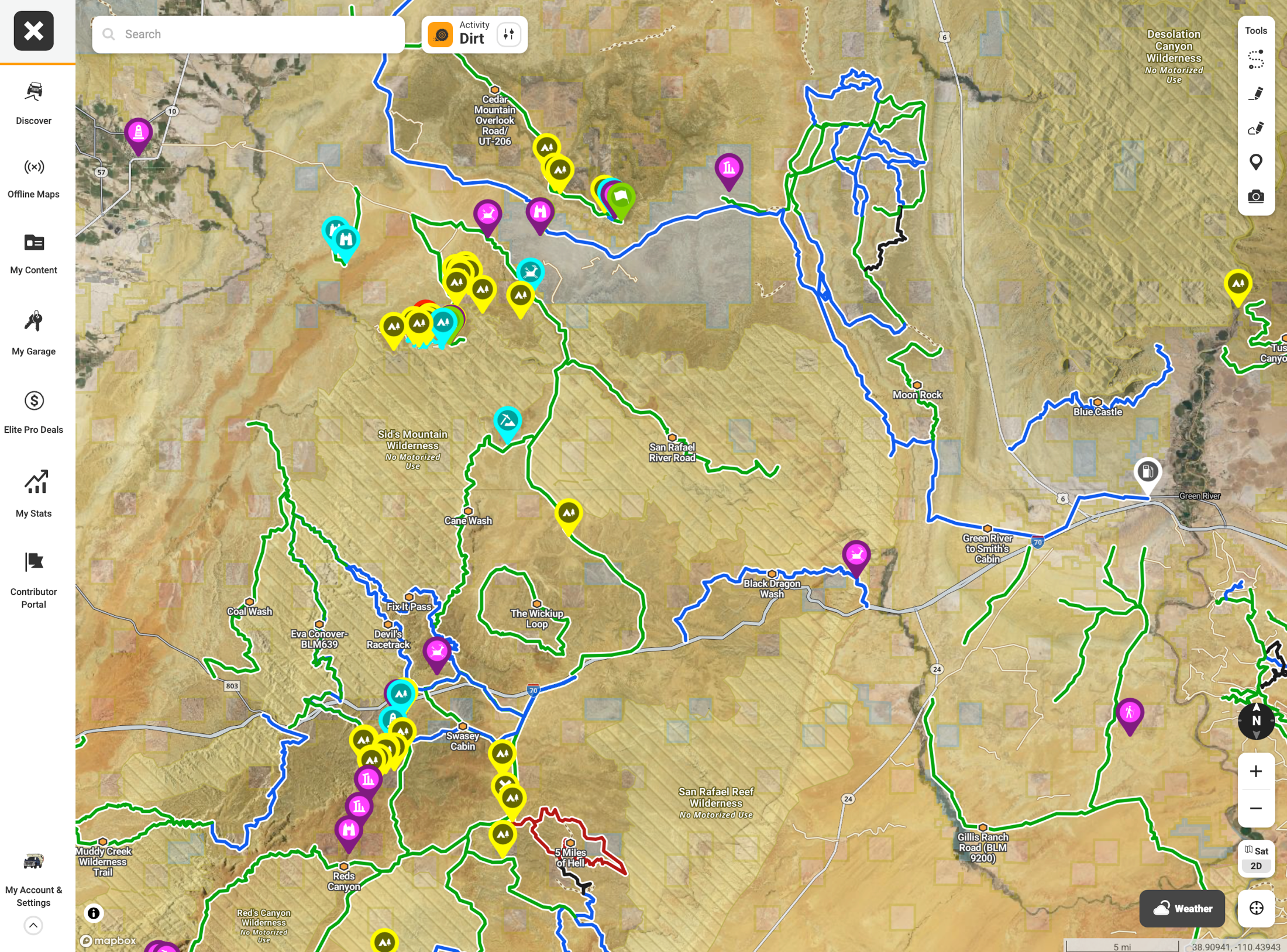
Indeed, the adventure starts before we leave home with the process of preparing for the trip ahead. And our primary tool for exploring and saving options is onX Offroad. It seems like just the right collection of tools, maps, and content to help us plan awesome adventures using satellite imagery, 3D tilt, offline maps, and markup tools (waypoints, routes) to save options. We use the markup tools to add potential off-road trails, dispersed campsites, hiking trails, cool points of interest, gas stations, restaurants, etc. We often drop more waypoints using the "mark location" feature on onX Offroad in the CarPlay app to mark additional dispersed campsites. And when we meet fellow travelers along the way, they often share cool ideas for new places to explore which also get added to the map.
All of those markups can quickly add up, making the mapping cluttered and hard to quickly understand. So to help keep our map organized and easy to understand at a glance, we've developed our own "map key" for using colors, icons, and line styles to make the markups we add to onX Offroad more meaningful and standardized. We call it our "onX Offroad Map Key".

While our Map Key is fairly self-explanatory, it might be helpful to explain some of the decisions behind why we picked some of these styles:
Colors
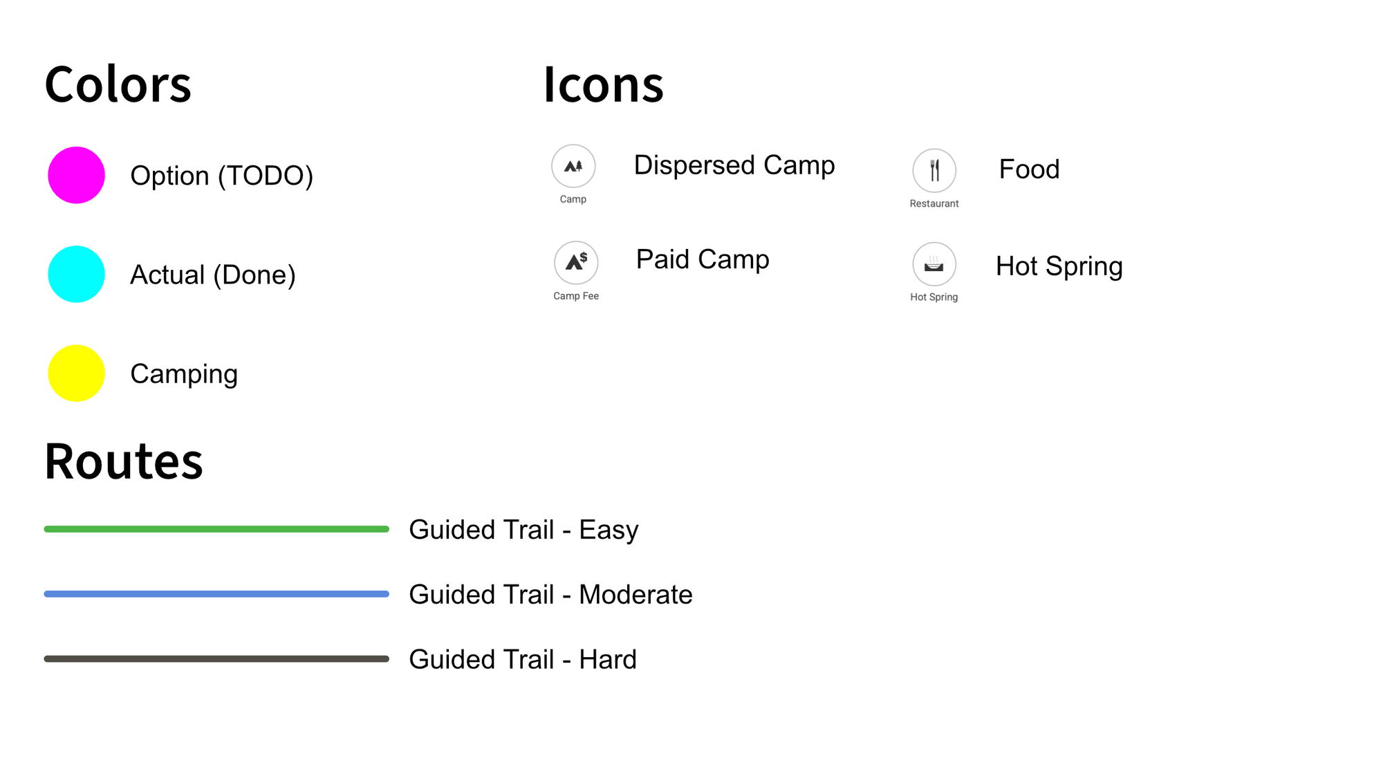
After considering how we travel and navigate to waypoints, we determine that they normally fall into one of four categories - a todo eg "option" (something we want to do), a todone (something we've already done but want to remember, revisit, or be able to share with someone else), camping (we need to sleep somewhere every night), and resources (filling up gas, water, food, etc). We use the same color key for both waypoints and routes. These categories might be different for your use case so pick what works for you. There are also additional colors available in onX Offroad which we don't currently use.
Icons
Colors further refine meaning by icons for things like dispersed camp vs campground, off-road trail, restaurant, etc. These icons might be different for your use case so pick what works for you. We sometimes use additional icons as needed.
Line Styles
Line style further refines meaning for things like primary vs alternate route and driving vs hiking. We also try not to use the colors associated with Guided Trails so that it's easy to determine which routes we created vs which are part of the 16,000+ Guided Trails created by onX Offroad Trail Guides.

While we're always evolving our workflows and tools, Our Map Key has been very helpful since we first standardized it about a year ago. We hope it helps you to prepare for your upcoming adventures. You can also learn more about how we use onX Offroad in our video "How we find overland routes and camping: onX 2025 Deep Dive".
See you out there,
-Adam
